3/24/07 20 years or less than 6 months?
Now you'll see the chronology of tract map 35022 from start May 16th, 1984 to it's final City Council approval on July 20th, 2004 then you can decide if we have cause for concern.
This 20 years sounds like a long time for a plan to be in the process of gaining departmental approval but when we look at the actual number of days the various departments reviewed the plan we see that these numbers are deceiving.
Hours of research and countless trips to City Hall were performed by Myself, and Tamie to reconstruct this timeline as close to exact as possible.
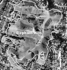
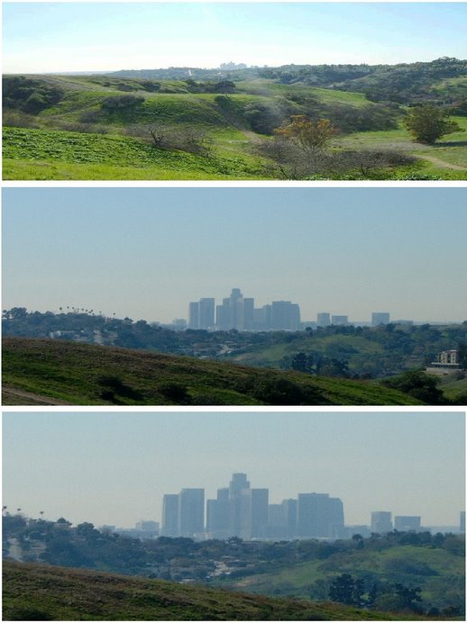
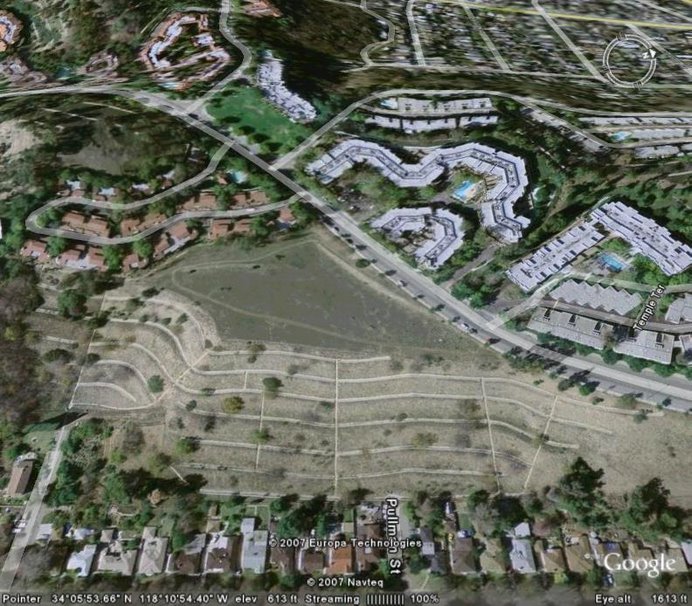
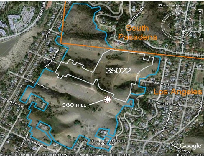
After an 'initial study' on May 16th, 1984 the 'Environmental Review Committee' (ERC) a division of the Los Angeles Planning Department, determined that the proposed plan for TT35022 which called for 30 'single family' lots on 18.67 acres in the Northeast Hills of Los Angeles [Council District 14] might have a significant effect on the environment, therefore the ERC ordered an Environmental Impact Report (EIR) to address the following areas of potential impact:
-Major Land Forms (grading)
-Flood Hazard
-Right-of-Way and Access
-Fire Protection
-Cultural Resources (Archaeology)
-Energy Conservation
The ERC also required an alternate grading plan be assessed for fewer than 30 single family homes with BALANCED cut and fill. [a 'BALANCED' site is one that requires no dirt to be hauled in or out, totally eliminating the need for 'Haul Route' approval.]
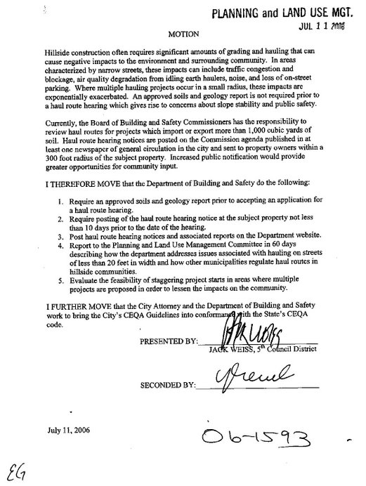
The PLUM Commission has recently passed a motion [see below] (#06-1593 dated 7-11-2006) through the City Council relating to this topic, it calls for a few more requirements prior to even scheduling a haul route hearing AND it calls for the City Attorney and the Department of Building and Safety work
to bring Los Angeles' CEQA guidelines into conformation with the State's CEQA code.
In addition to the above mentioned six items called out by the ERC after the initial study a second 'Initial Study' (their words not mine) was prepared in June of 1989 and added the following two areas of concern along with a statement requiring the developer to assess the 'cumulative impacts' of the project on all of the above items plus the 2 new items as well:
-Service systems (sewers), and
-Water Conservation
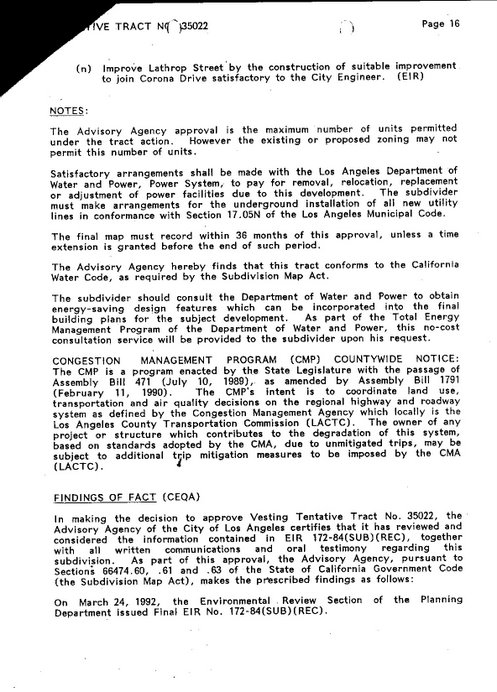
When the zoning of the site was changed from R1 to RE20, [see 'Getting Zoned']the project was re-designed to conform to a low housing density requirement. After a lapse of 5 years, a second Notice of Preparation was prepared and circulated for the property in June-July, 1989. A draft EIR for the proposed project was prepared [by companies [Triad] hired by the developer] and circulated for public review from January 16, 1992 to March 2, 1992.
[note: Greenhills Investments is still listed as the owner of record at this time but the connection
between William Foote and tract map 35022 can already be made.}
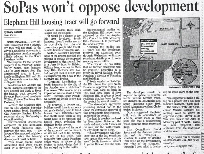
Planning Department documentation indicates that, on January 6, 1993, the Planning Department held a public hearing on proposed tract 35022. Residents from some of the neighborhoods impacted by the proposed project testified in opposition to the proposed plan. Despite community objection and the EIR's pseudo recommendation to change the land use to open space, the plan was approved by the Planning Department. [Thank You planning dept. ... NOT] [MND's would have been helpful at that time]
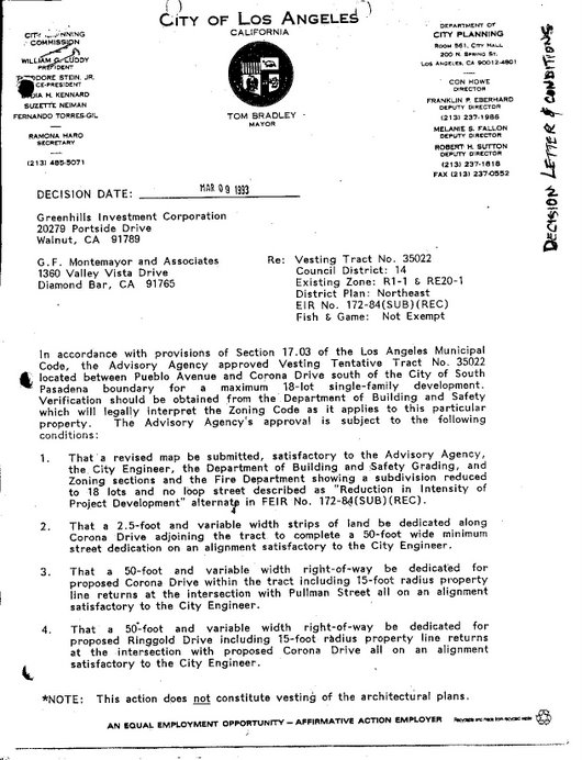
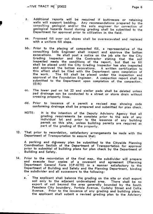
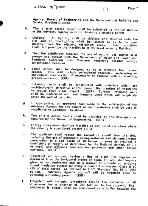
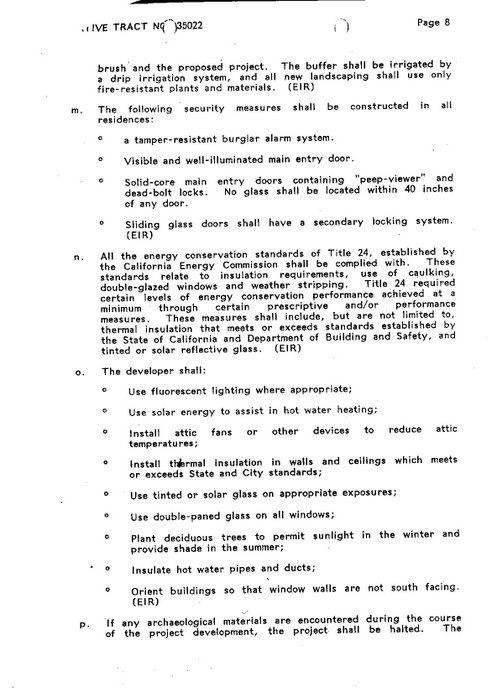
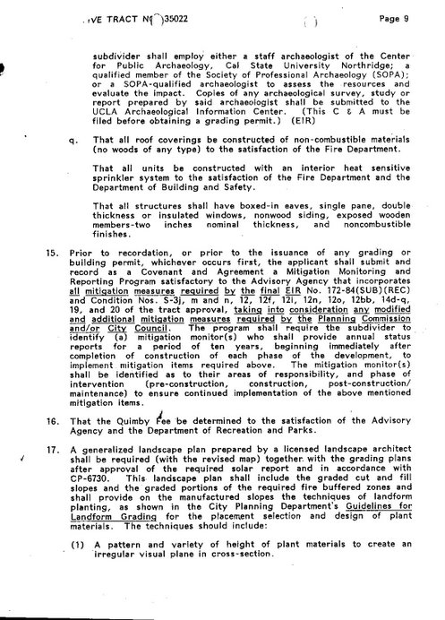
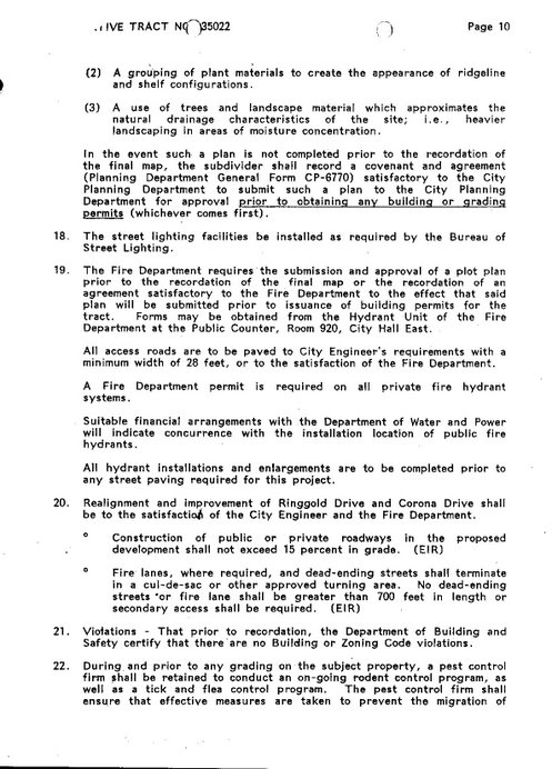
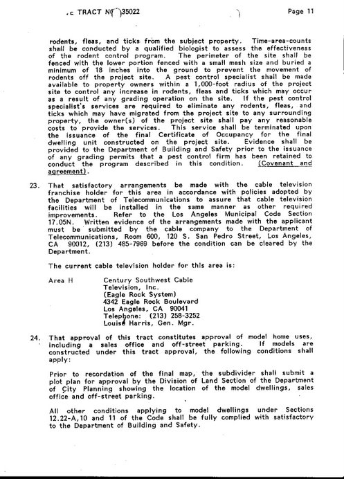
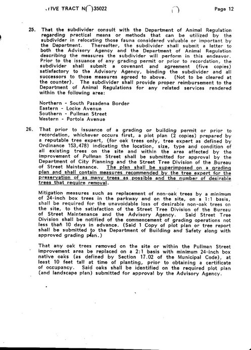
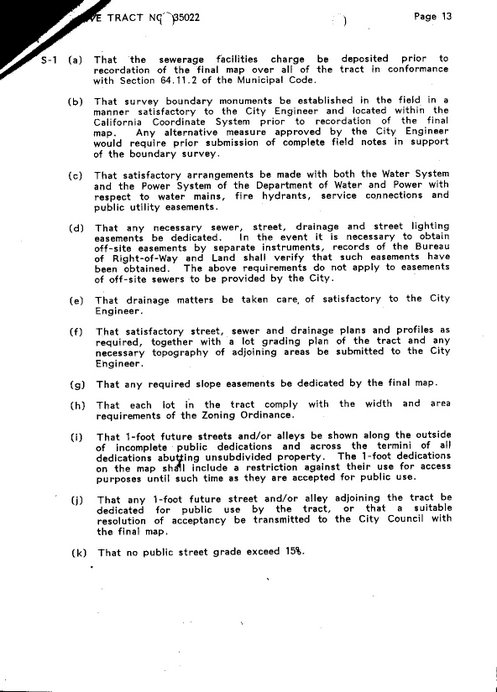
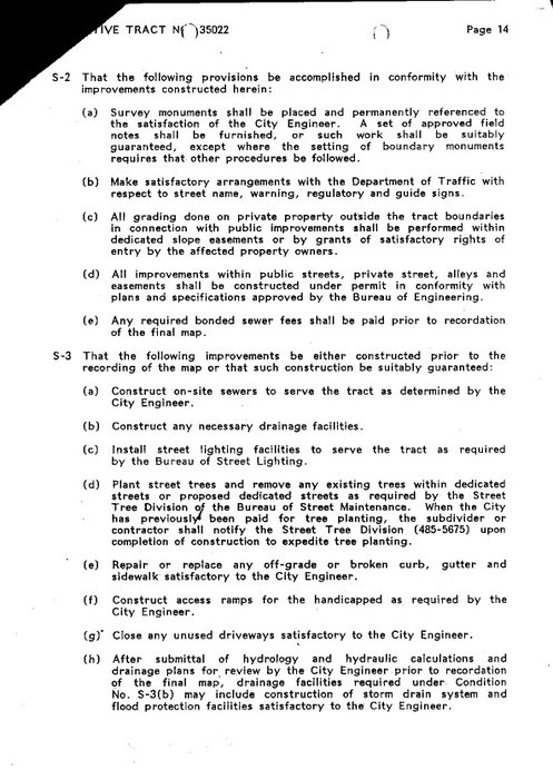
On March 9, 1993, the Los Angeles City Planning Commission issued a decision, approving the vesting of tract number 35022 for a maximum of 18-lot single family development, subject to 26 conditions primarily related to specific grading and construction details and conformity with city regulations and codes, conditions address factors to mitigate potential environmental problems specified in the EIR. [thanks again planning department...not]
On June 12, 1993, representatives from the Corona Drive Homeowners’ Association, the Pullman-Collis Ave. Homeowners’ Association and the Guardia Avenue Homeowners’ Association filed an appeal against the Planning Commission and the June 3, 1993 hearing that modified the Conditions of Approval for the tract vesting action, citing inadequate engineering for rain water runoff from the site and potential flooding and land movement.
On July 13, 1993, the City Council held a hearing on the appeal filed by the homeowners associations. In the homeowners’ written statement, residents opposed the plan and the proposed clarification to the conditions of approval based on the rain water run off and flooding concerns. According to a summary of the hearing, residents at the hearing urged that no more than 10 houses be allowed in the sub-division and expressed concerns about hillside grading, preservation of open space, the protection of wildlife, increased traffic on narrow streets and underground water and flooding. [there's the MND's... remember 'Getting Zoned' , only issues raised at this time can be brought up later]
At the hearing, an unspecified Field Deputy of then Councilman Richard Alatorre [remember MHC] recommended that the development now with 24 units (up from 18) be approved by the Planning Commission since it would require less grading than the 18 units previously approved. He also recommended that the Commission include conditions that the Councilmember requested to protect the existing houses below the proposed project.
ONE DAY LATER...
On July 14, 1993 the City Council took action and adopted the report of the Planning Commission (Question: what would motivate the planning department to create a report
which recommended this plan when at the exact same time the MHC fiasco was in full swing within spitting distance of this project? Answer: ... $$$) certified the EIR, adopted the findings of the Planning Departments’ Statement of Overriding Considerations (vesting of tract map) as the Councils findings, and denied the homeowners’ appeal, "thereby concurring and approving vesting tentative tract Map No. 35022." To satisfy the residents’ concerns, the Council clarified Condition No. S-3 of the original decision to include onsite and offsite storm drain system and flood protection facilities satisfactory to the City Engineer. [GEE THANKS] [this looks strangely like the SAME ACTION that was taken in 1989 {see above} but now they're calling out the appeal as the reason for taking action.]
Between 1993 and 2002, the City of Los Angeles and the state of California enacted various pieces of legislation which permitted the city to extend the life of tentative tract maps and parcel maps. According to a Planning Department memo dated November 4, 1999, "…the theoretical total time (not considering moratorium, unit maps and off site improvements) a tentative tract map or preliminary parcel map can be maintained as valid is now 11 years." According to this memo, the life of tract map 35022 would be extended until July 14, 2004 before it became invalid, and a new plan would have to be submitted, a new public hearing held. [This is exactly what the developer is afraid of, why ?, because the project is deeply flawed and will not pass under today's ordinances and grading regulations not to mention the USGS has identified the project area as a 'hazard zone' for liquefaction hazards on their most recent maps.]
A lot can change in 11 years, but how about the actual 20 years since this EIR first landed on the city planners desk way back in May of 1984 ? then I found this: [here's where it starts to get fishy from an administrative point of view]
The Planning Department documentation concerning tract map 35022 includes a letter dated February 11, 1998, addressed to property owners Greenhills Investment Corp. and signed by Darryl Fisher. After a summary of the government issued extensions, the letter indicates: "Therefore, the new expiration date for tract 35022 is July 14, 2002 and no further extensions of time to record a final map can be granted." The documentation also includes a copy of the February 11, 1998 memo with the year 2002 crossed out and 2004 inserted, this was initialed as follows: "F.T. 8-19-02."
[this could have been a simple typo but looking at the date of the correction we must ask
why this mistake wasn't caught earlier than August 19th 2002 ]
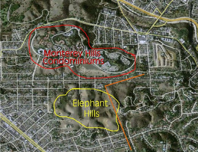
In the fall of 2003, residents in the El Sereno and Monterey Hills noticed significant surveying work being performed in the area. [watch for my blog post 'Illegal Grading' coming soon.]
Documentation on file at the Planning Department indicates that the property owners are taking action to complete the remaining 26 conditions of approval for final recording of the tract map in order to break ground and begin construction.
[note: now it is the beginning of 2003, there are still 26 conditions left to satisfy with only months before the expiration of tract 35022, By the time this is done I'll be on a first name basis with the 'Public Counter' people at city hall]
On December 10, 2003, the Planning Department received a memorandum from the SWD Communities, LLC, requesting a revision of Tentative Map for Tract 35022, dated November 12, 2003. This documentation specified that the current owner of the property is Monterey Hills Partners, LLC, 3 Civic Plaza, Suite 240, Newport Beach, CA and the current engineer is Jim Emerson, PE, 24 W. Saint Joseph Street, Arcadia, CA. William D. Foote signed the document as owner or sub divider. Attached to the memorandum is a revised map for the tract documentation.
[note: this revision is allowed without any public input, completely circumventing the process]
Another document dated December 29, 2003 was found in the Planning Department file. This is a letter from the Planning Department to SWD Communities and LLC and GF Montemayor, another engineering firm involved in the 1993 tract mapping activity, calculating the Quimby fee of $36,336.00 that must be paid to the Department of Parks and Recreation prior to recording of the tract map.
[ah-ha now we are starting to get an idea of where our planning department's priorities lie]
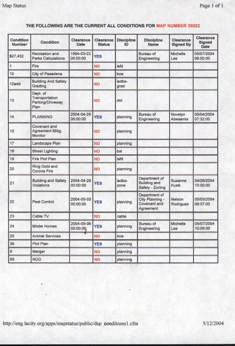
According to the Los Angeles Bureau of Engineering’s map status report for Tract 35022, dated December 29, 2003, the property owners had only completed two of the 26 conditions of approval.
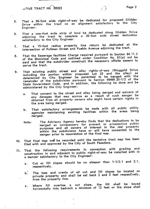
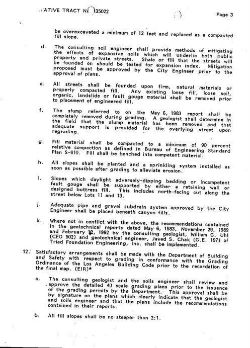
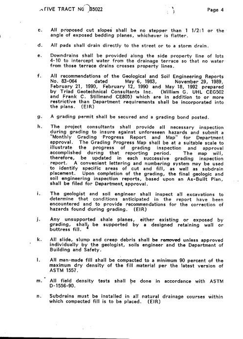
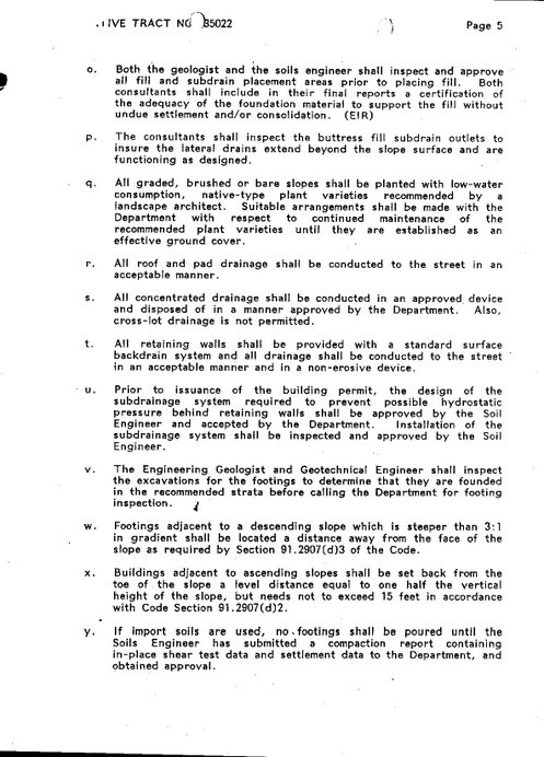
[note: here we are at the end of 2003, just 2 of the 26 conditions have been completed keep in mind, many of these original 26 conditions are broken down into what can only be described as 'sub'conditions' for example condition # 9 has parts A and B. And condition #11 includes 11A - 11K]
to be continued...









No comments:
Post a Comment